WorldmapPDF
Map of Canada with cities and capital.
View detailed maps of Canada in HD and in different formats such as JPG, PDF, PNG. Maps in PNG format are often of better quality.


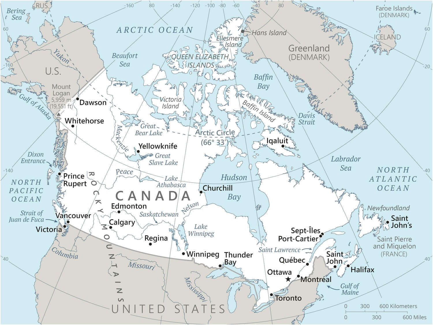
Simple map of Canada

Download: JPG (800 x 601 pixels) | JPG (1500 x 1127 pixels) | JPG (3338 x 2508 pixels) | PNG | PDF
Description: Simple map of Canada with cities, capital, lakes and rivers.
License: Royalty free
Author: US Government, Central Intelligence Agency
Source file: The World Factbook 2024 Central Intelligence Agency.
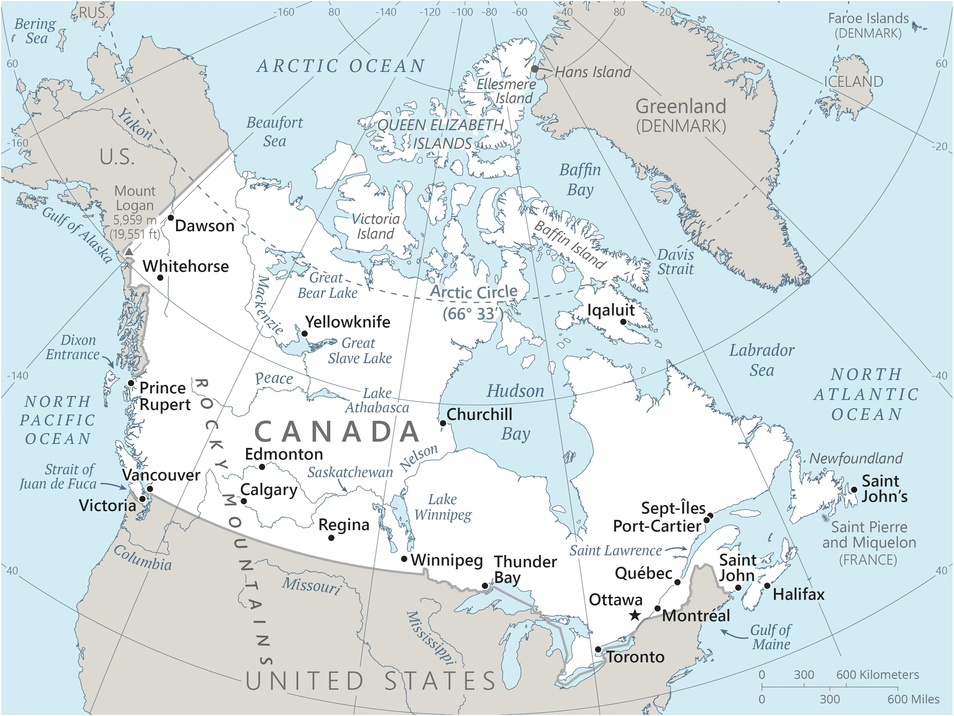
Description: Simple map of Canada with cities, capital, lakes and rivers.
License: Royalty free
Author: US Government, Central Intelligence Agency
Source file: The World Factbook 2024 Central Intelligence Agency.
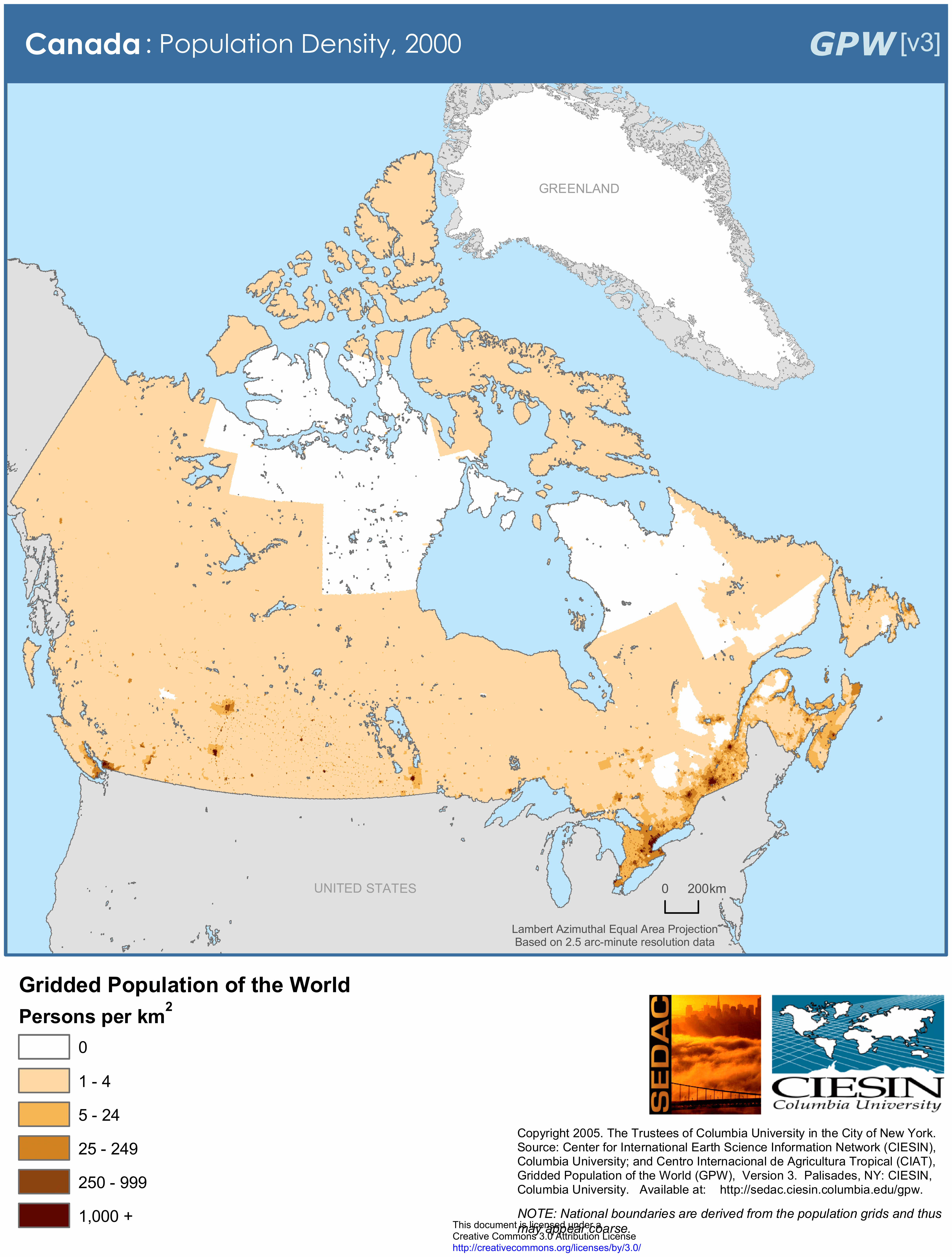
Map of Canada with population density

Download: JPG (606 x 800 pixels) | JPG (2273 x 3000 pixels) | JPG (4859 x 6414 pixels) | PNG | PDF
Description: Map of Canada with population density in inhabitants per square kilometer in 2000.
License: CC BY 3.0
Author: Center for International Earth Science Information Network (CIESIN)
Source file: Columbia University of New York (SEDAC)
Description: Map of Canada with population density in inhabitants per square kilometer in 2000.
License: CC BY 3.0
Author: Center for International Earth Science Information Network (CIESIN)
Source file: Columbia University of New York (SEDAC)
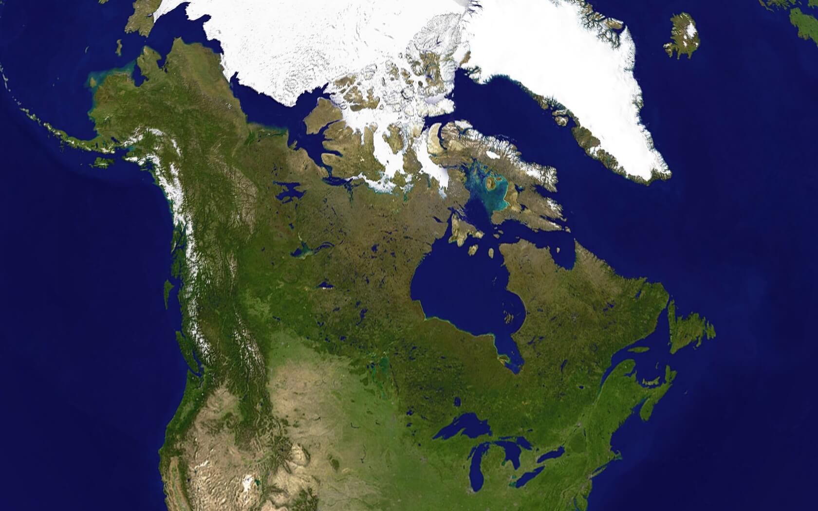
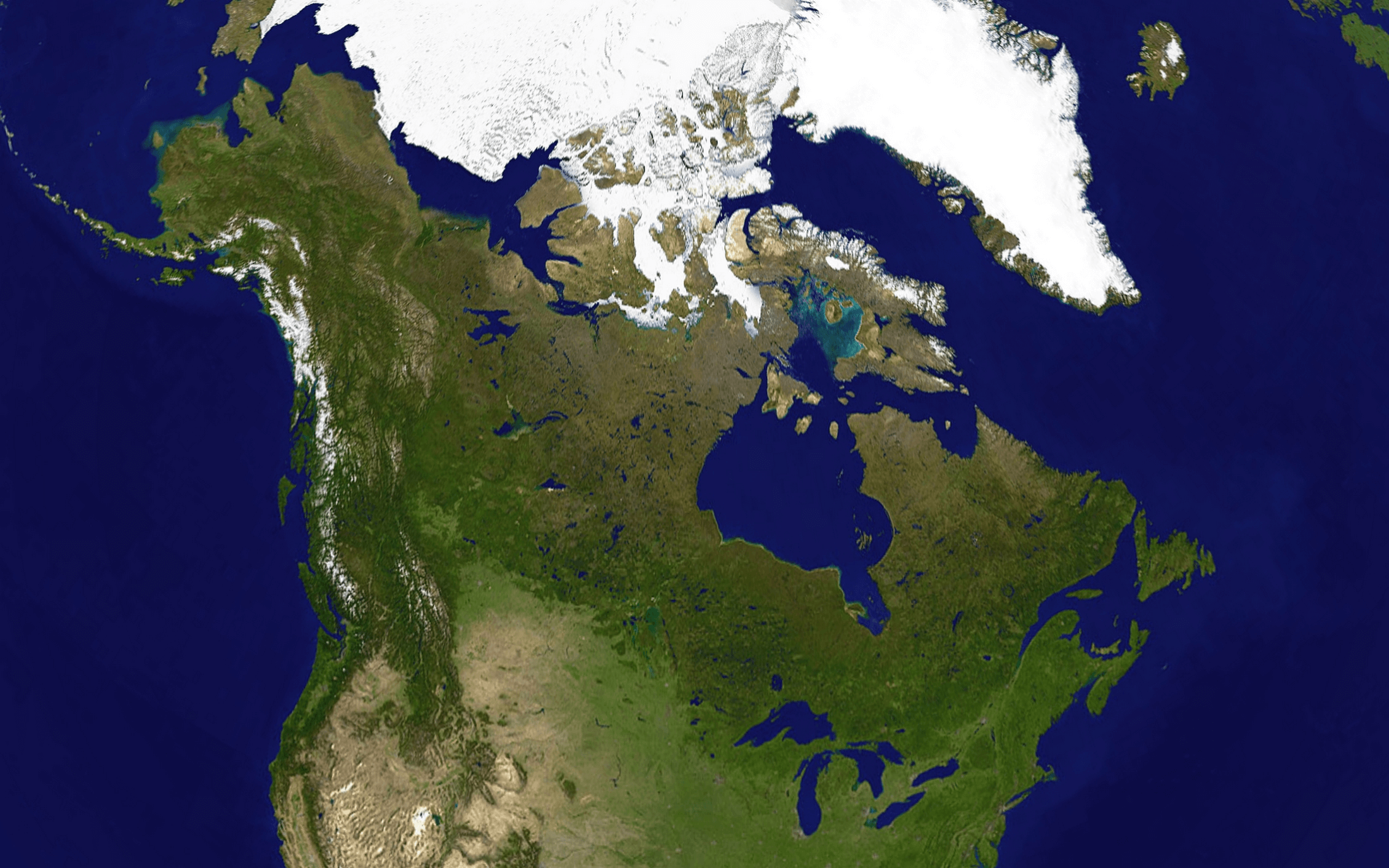
Satellite photo of Canada
